Tourism in the
Province of Loja
Tourism in Loja
Tourism in Loja
GR
The province of Loja has 440,000 inhabitants, 220,000 urban and 220,000 rural.
The surface of the province of Loja is 11,000 square kilometers, divided into 16 cantons.
The province is known for its silver crafts and woolen fabrics.
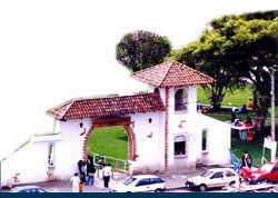
Foto: I. M. Loja
MUNICIPALITIES / CANTONS
- The city of Loja is the capital of the province of Loja and has 130,000 inhabitants.
Macará
- Macará is in the southwest of Loja. Macará is 190 km from Loja.
Paltas
Calvas
- Cariamanga is in the southwest of Loja at a distance of 11 km.
- The Puyango Petrified Forest has stones between 65 and 100 million years old. How to get there: Machala - Arenillas - Río Puyango or the route Loja - Alamor - Río Puyango.
Saraguro
- Saraguro is in the north of Loja. Saraguro is 65 km from Loja.
Celica
- Celica is located in the southwest of Loja.
Catamayo
- Catamayo is in the west at a distance of 40 km from the city of Loja.
Espíndola
Gonzanamá
- Gonzanamá is in the southwest of Loja. Gonzanamá that 80 km from Loja.
Quilanga
- Quillanga is in the southwest of Loja.
Sozoranga
- Sozoranga is in the southwest of Loja.
Zapotillo
- Zapotillo is in the southwest of Loja. Zapotillo is 220 km from Loja.
Chaguarpamba
Pindal
- Pindal is in the west of Loja.
CAMARA DE TURISMO DE LA PROVINCIA LOJA
Teléfono: (593)
GOBIERNO DE LA PROVINCIA DE LOJA
Teléfono: (593)
Other cities and sites
Other provinces
Imbabura - Loja - Los Rios - Manabi - Morona Santiago - Napo - Orellana - Pastaza - Pichincha - Santa Elena
OTHER INTERESTING SITES
- Vilcabamba is in the south of Loja, and it is very famous because people reach older ages. Vilcabamba is at a distance of 50 km from Loja.
- The Podocarpus National Park has an area of 146,280 hectares and is accessible from Loja, Zamora and Vilcabamba.
- Zamora is to the east of the city of Loja in the Zamora Chinchipe province.


