


General Information of Ecuador
General Information of Ecuador
General Information Ecuator - South America
REPUBLIC OF ECUADOR
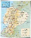
REGIONS, PROVINCES + POPULATION
The continental territory and islands of Ecuador has a total of 256.370 square kilometers.
In the year 2000, according to the INEC, the total population of 12.646.095 inhabitants was divided into 6.350.427 men and 6.295.668 women. The urban areas were populated by 8.098.436 inhabitants and the rural ones by 4.547.659 Ecuadorians.
The 22 counties of the country are integrated by 215 cantons that include a total population of 12.646.095 inhabitants, calculated for the year 2000 by the National Institute of Statistic and Census (INEC). In the year 1900 only 48 cantons existed, in 1950 they were increased to 87, in 1975 they already totalled 116, and when concluding 1999 they totalled 215, divided this way: 83 in the Coast, 91 in the Sierra, 38 in the Amazonia and 3 in Galapagos.
Ecuador is formed by four natural regions:
Coast or Costa, located in the western fringe. The 5 coastal counties have a total population of 6.388.089 inhabitants, divided in: urban 4.562.364, and rural 1.825.725 inhabitants.
Highlands, Interandina or Sierra, called this way being part of the mountainous alley of the mountain range. The 10 highland counties have a total of 5.627.750 inhabitants, of those 3.357.293 are located in the urban areas and 2.270.457 in the rural ones.
Amazon or Trasandina, integrates the denominated continental area " Amazonia ". The 6 oriental counties have a total of 613.339 inhabitants, 210.829 settled down in the urban areas and 402.510 in the rural areas.
Galápagos Islands, integrated by the county of Galapagos, an archipelago of 13 islands and 17 smaller islands located 1.000 kilometers to the west of the Ecuadorian continental territory. The insular county of Galapagos has a total population of 16.917 inhabitants, 15.554 remain in the urban areas and 1.903 in the rural areas.
GR
El Oro: 14 cantons, 559.846 inhabitants, 423.324 urban and 136.522 rural. The city of Machala has more than 219.093 residents and the canton 236.349. The 13 cantons 323.497 residents. The county The Gold has 5.849,7 square kilometers of surface. Cantons: Máchala, Arenillas, Atahualpa, Balsas, Chilla; El Guabo, Huaquillas, MarcabelÍ, Pasaje, Pinas, Portovelo, Santa Rosa, Zaruma y Las Lajas. 27 urban parishes and 50 rural.
Emeraldas: 7 cantons, 416.272 inhabitants, 203.176 urban y 213.096 rural. The city of Emeraldas has 128.762 and the canton 179.124 residents. The 6 cantons 237.148 residents. The county Emeralds have 15.573,4 square kilometers of surface. Cantons: Esmeraldas, Eloy Alfaro, Muisne, Quinindé, San Lorenzo, Atacames y Río Verde. 10 urban parishes and 66 rural.
Guayas: 28 cantons, 3.418.741 inhabitants, 2.889.884 urban and 528.857 rural. The city of Guayaquil has more than 2.140.288 residents and the canton 2.188.663. The other 27 cantons 1.278.453 inhabitants total. The county Guayas has 20.557,8 square kilometers of surface. Cantons: Guayaquil, Alfredo Baquerizo Moreno, Balao, Balzar, Colimes, Daule, Duran, El Empalme, El Triunfo, Milagro, Naranjal, Naranjito, Palestina, Pedro Carbo, Salinas, Samborondón, Santa Elena, Santa Lucía, Salitre, Yaguachi; Playas, Simón Bolívar; Coronel Marcelino Maridueña, Lomas de Sargentillo, Nobol, La Libertad, General Antonio Elizalde, Isidro Ayora, 51 urban parishes and 44 rural parishes.
Los Ríos: 12 cantons, 662.844 inhabitants, 343.975 urban and 318.869 rural. The city of Babahoyo has 84.164 residents and the canton 138.322 residents. The 11 cantons 524.522 inhabitants. The county Los Ríos (The Rivers) has 7.176,2 square kilometers of surface. Cantons: Babahoyo. Baba, Montalvo, Puebloviejo, Quevedo, Urdaneta, Ventanas, Vinces. Palenque, Buena Fe, Valencia and Mocache. 23 urban parishes and 17 rural.
Manabí: 22 cantons, 1.267.844 inhabitants, 654.463 urban and 613.381 rural. The city of Portoviejo has 188.184 and the canton 266.251 residents. The 21 cantons 1.001.593 residents. The county Manabí has 18.883 square kilometers of surface. Cantons; Portoviejo, Bolívar, Chone, El Carmen, Flavio Alfaro, Jipijapa, Junín, Manta, Montecristi, Paján, Pichincha, Rocafuerte, Santa Ana, Sucre, Tosagua, 24 de Mayo, Pedernales, Olmedo, Puerto López, Jama and Jaramijó. 35 urban parishes and 60 rural,
Morona Santiago: 10 cantons, 143.348 residents, 57.467 urban and 85. 881 rural. The city of Macas 31.535 inhabitants and the canton Morona 55.658. The 9 cantons 87.690 residents. The county Morona Santiago has 25.691 square kilometers of surface. Cantons: Morona, Gualaquiza, Limón Indanza, Palora y Santiago, Sucúa, Huamboya, San Juan Bosco, Taisha and Logroño. 11 urban parishes and 59 rural.
Napo: 5 cantons, 89.121 inhabitants, 32.363 urban and 56.758 rural. The city of Tena 20.998 residents and the canton totals 55.042. The 4 cantons 34.079 residents. The county Napo has 13.271,1 square kilometers of surface, 7 cantons: Tena, Archidona, El Chaco, Carlos J. Arosemena Tola and Quijos. 5 urban parishes and 22 rural.
Orellana: 4 cantons, 70.553 inhabitants, 24.678 urban and 45.673 rural. The city of Francisco of Orellana or Coca has 18.171 residents and the canton 33.844. The 3 cantons 36.709 residents. The county Orellana has 20.732,9 square kilometers of surface. Cantons: Orellana, Aguarico, Joya de los Sachas and Loreto. 4 urban parishes and 29 rural.
Pastaza: 4 cantons, 62.110 inhabitants, 27.938 urban and 34.172 rural. The city of Puyo 25.790 residents and the canton Pastaza 44.621. The 3 cantons 17.489 residents. The county Pastaza has 29.699,7 square kilometers of surface, 4 cantons: Pastaza, Mera, Santa Clara and Arajuno. 4 urban parishes and 19 rural.
Sucumbíos: 7 cantons, 144.774 inhabitants, 46.870 urban and 97.904 rural. The city of Nueva Loja or Lago Agrio has 28.257 residents and the canton Sour Lake 68.868. The 6 cantons 75.906 residents. The county Sucumbíos has 18-330,6 square kilometers of surface. Cantons: Lago Agrio, Gonzalo Pizarro, Putumayo, Shushufindi, Sucumbíos, Cáscales and Cuyabeno. 7 urban parishes and 28 rural.
Zamora Chinchipe: 4 cantons, 103.233 inhabitants, 39.567 urban and 63.666 rural. The city of Zamora has 18.216 residents and the canton 35.821. The 3 cantons 67.412 residents. The county Zamora Chinchipe has 23.116,6 square kilometers of surface. Cantons: Zamora, Chinchipe, Nangaritza, Yacuambi, Yantzaza, El Pangui, Centinela del Cóndor and Palanda. 8 urban parishes and 26 rural.
Galápagos: 3 cantons, 16.917 inhabitants, 15.014 urban and 1.903 rural. The city of Puerto Baquerizo Moreno has 5.842 residents and the canton San Cristobal 6.465. The 2 cantons 10.452 residents. The county Galápagos has 8.010 square kilometers of surface. Cantons: San Cristóbal, Isabela y Santa Cruz. 3 urban parishes and 16 rural.
INFRASTRUCTURE
INFRASTRUCTURE HEALTH
The infrastructure of health is composed by hospitals, clinics, maternities, centers, subcentros and positions of health, clinics and medical centers, and policlinics; the administration, operability and maintenance of them, in the 22 Ecuadorian counties, are in charge of state organisms. They serve a national total of 3.790 establishments of medical attention with a global endowment of 14.854 beds.
EDUCATIONAL INFRASTRUCTURE
The educational, public and particular infrastructure that works in the 22 counties of the country is conformed by establishments preprimarios, schools, highschools, universities and polytechnic schools. Their teaching levels are the following: The level preprimary totals 4.052 establishments; the primary level, 17.554 schools; the middle level, 3.275 schools; and, the higher level, 40 universities and 7 polytechnic schools.
SPORT INFRASTRUCTURE
The state and private infrastructure dedicated to the practice of the sport in massive form is conformed by soccer stadiums, coliseums, gyms, velodromes, pools, athletic courts of multiple use. The 22 counties of the Ecuador have an approximate total of 350 main sport scenarios and of higher capacity.
ENERGY INFRASTRUCTURE
In the continental and Galapagos Islands Ecuador, a total of 22 companies electric matters and public: 8 power stations of hydroelectric generation and 14 of thermoelectric; and, 7 distribution facilities, located in the oriental counties, not incorporate to the Interconnected National System. They attend 2.223.292 subscribers, divided in 1.940.680 residential, 225.109 commercial, and 26.783 industrial.
TRANSPORTATION INFRASTRUCTURE
The Ecuadorian transportation infrastructure that intercommunicates the three Ecuadorian regions, totals 10.506 kilometers conformed by paved highways, of concrete, gravalled and bridges.
INDUSTRIAL INFRASTRUCTURE
The infrastructure industrial Ecuadorian is divided by productive activities in: agricultural, agroindustrial, piscícola, nutritious, drinks, timber, ceramic, marble, construction, textile, leathers, joyera, chemistry, rubbers, plastic, metalmecánica, etc. In the country, according to registrations of the National Federation of Cameras, a total of 13.367 industries that you/they are vital part of the great productive apparatus that sustains the national economy works.
COMMERCIAL INFRASTRUCTURE
In the main cities of the country, the formal merchants are contained in chambers, which look after the interests of their members, lending them permanent advice on the execution of the legal norms that govern their activities. The 17 Chambers of Commerce count approximately 20.000 members, proprietors of same number of establishments dedicated to the import, sale and distribution of national and foreign products, and services of diverse nature. The informal merchants remain independent or they conform small associations according to the branch of their activity. There are small merchants' collective groupings, retailers, distributors, commission agents.
AGRICULTURAL INFRASTRUCTURE
The farmers of the country have grouped in two types of organizations: cantonal agricultural centers and zonal chambers with provincial representations. The entities of more representativeness are the chambers of Quito and Guayaquil that agglutinate to the counties of the two regions. The chamber of the first area is conformed by 3.500 members of the counties of Carchi, Imbabura, Pichincha, Cotopaxi, Tungurahua, Chimborazo and Bolivar. That of the second area, with seat in the city of Guayaquil, has more than 5.000 members that represent the counties of Emeraldas, Manabí, Guayas, Los Ríos and El Oro. The southern region, integrated by the counties of Azuay, Loja and Cañar, registers 2.000 farmers approximately. The thousands of small farming managers of the amazon region have conformed their zonal chamber.
TOURISTIC INFRASTRUCTURE
The tourist infrastructure distributed in the 22 Ecuadorian counties understands: hotels, inns, hostels, travel agencies, operators of tourism, bars, restaurants, sodabars, discos, etc., registers a total of 5.386 establishments.
EXTERNAL TRADE
At the end of the year 1999, in the period January-December, the Ecuadorian external trade registered total revenues for the quantity of 4,162 millions 031 thousand dollars, 1.361 millions 538 thousand dollars coming from oil exports and 2.800 millions 493 thousand dollars corresponding to external sales of bananas, elaborated foods, shrimps, cocoa and elaborated, tuna fish and primary materials, non traditional products, natural flowers, juices and concentrate of fruits, flour and canned fish, seafood, chemical and fármacos, vehicles, garments, clothes, leather, plastic, rubber, metals. The imports of consumption goods, materials and capital, demanded 2.814 millions 248 thousand dollars,
POLITICAL DIVISION
The Political Constitution of the Republic of the Ecuador, approved June of 1998, 5 in the city of Riobamba, headquarters of the foundation of the Ecuadorian State in 1830, entered in validity at the 10 th August 1998 with the possession of the Constitutional President of the Republic. The second article declares that the Ecuadorian territory is inalienable and irreductable. It is mainly the "Real Audience of Quito" with all its modifications.
The article 224 points out that the territory of the Ecuador is indivisible. For the administration of the State and the political representation counties, cantons and parishes will exist. There will be indigenous and afroecuatorian territories or districts that will be established by the Law.
In the counties there will be a governor, representative of the President of the Republic. The autonomous sectional governments will be exercised by the "provincial councils", the municipal town councils, the parish meetings and the organisms that is determined the Law for the administration of the indigenous and afroecuatorianas territorial circcunscripciones .
The counties, cantons and parishes will be able to associate for their economic and social development, and for the handling of the natural resources.
The Provincial Council represents to the county, the Municipality the canton and the Parish meeting to the rural parish.
TRANSPORTATION
Air:
Transportes Aéreos Militares Ecuatorianos Tame, Saeta, Ecuatoriana de Aviación, AEROGAL Austro Aéreo y Aeca.
Sea:
Transportes Navieros Ecuatorianos (Transnave), y Flota Petrolera Ecuatoriana.
Earth:
Transportes Ecuador, Panamericana Internacional, Aerotaxis, Flota Imbabura, Expreso Tukán, Pullman Carchi, Tax Gacela, Vencedores, Transportes Occidentales, Trans Esmeraldas, Reina del Camino, Carlos Alberto Aray, Transportes Zaracay, Express Sucre, Ejecutivo San Luis, Super Semería, Transportes Santa, Flota Bolívar, Patria, Riobamba, Gran Co lombiana, Chimborazo, Atlántida, Turismo Oriental, Centinela del Sur, Cooperativa Loja, Viajeros, Cooperativa Ciro, Expreso Bolivariano, Flota Cotopaxi, Ecuatoriano Pullman, Rutas Orenses, Cooperativa Baños, Cita Internacional y Trasandina.
Sources + Thanks:
REVISTA VISTAZO, EL UNIVERO, EL COMERCIO, EL HOY, LA HORA, INEN, INEC, SISE, IGM, et. al..
Great part of data is from the year 2003, but there are also some data from the year 2001.
Adaption y translation CODESO, latest changes of contents 01/2004.
Please send us a note if there is any translation error, we will appreciate.
COMUNICATIOS
Press:
Quito: El Comercio, Diario Hoy, Últimas Noticias, La Hora, Líderes.;
Guayaquil: El Universo, Expreso, Extra, El Telégrafo, Meridiano, El Financiero.
Cuenca: El Mercurio, El Tiempo.
Ambato: El Heraldo.
Manta: El Mercurio.
Portoviejo: El Metropolitano, El Diario.
Máchala: El Nacional, Correo, Opinión.
Riobamba: El Espectador, La Prensa.
Loja: El Siglo, Crónica de ia Tarde, Frontera Sur.
Quevedo: Ecos de Quevedo.
Babahoyo: El Clarín.
Ibarra: Diario del Norte.
Radios:
The main radio chains of the country that maintain national informative spaces in modulated width (AM) and modulated frequency (FM) are the following:
HCJB La Voz de los Andes, Quito, Centro, Sonorama. Bolívar, Francisco Stereo, Visión, Democracia and La Luna in Quito; Sucre, Atalaya, Cristal, Caravana, Carrousel, CRE, F.l Telégrafo and Huancavilca en Guayaquil; Centro and Paz y Bien en Ambato; Spléndid, La Voz del Tomebamba, Ondas Azuayas and Mercurio in Cuenca.
In the other cities of the Ecuadorian territory several radio stations exist with local or regional signals that offer music, sport programming, of entertainment and TV Education:
Ecuavisa, Teleamazonas, TC Televisión, Gamavisión, Telesistema, ETV-Telerama, TV Hoy, Manavisión, Telecosta, Andivisión, Telesucesos, SiTV, Asomavisión, Ambavisión, Teleandina, Cablenoticias, Cabledeportes, UV Televisión, Televisora del Norte and Televisión Satelital.
Press:
Guayaquil: Vistazo, Hogar, Estadio, Generación XXI, Crecer Feliz; Quito: Cosas, Ekos Economía, Gestión, Mango, Mundo Diners.
Azuay: 14 cantons, 626.857 inhabitants, 327.433 urban and 299.424 rural. The city of Cuenca has more than 279. 963 residents and the canton 429.284. The 13 cantons 197.573 residents. The county Azuay has 8.127,3 square kilometers of surface. Cantons: Cuenca, Girón, Gualaceo, Nabón, Paute, Pucará, San Fernando, Santa Isabel, Sigsig, Oña, Chordeleg, El Pan, Sevilla de Oro and Guachapala. 27 urban parishes and 68 rural.
Bolívar: 7 cantons, 183.665 inhabitants, 51.596 urban and 132.069 rural. The city of Guaranda has 19.980 residents and the canton 73.938. The 6 cantons 109.727 residents. The county Bolivar has 3.941.6 square kilometers of surface. Cantons: Guaranda, Chillanes, Chimbo, Echeandía, San Miguel, Caluma and Las Naves. 9 urban parishes and 21 rural parishes.
Cañar: 7 cantons, 217.020 inhabitants, 80.319 urban and 136.701 rural. The city of Azogues (Quicksilver) has 32.240 residents and the canton 69.641. The 6 cantons 147.379 residents. The county Cane plantation has 3.123,5 square kilometers of surface. Cantons: Azogues, Biblián, Cañar, La Troncal, El Tambo, Déleg and Suscal. 10 urban parishes and 30 rural.
Carchi: 6 cantons, 167.175 residents, 77.834 urban and 89.791 rural. The city of Tulcán has 50.567 residents and the canton 80.538. The 5 cantons 88.680 inhabitants. The county Carchí has 3.602 square kilometers of surface. Cantons: Tulcán, Bolívar, Espejo, Mira, Montúfar and Huaca. 10 urban parishes and 28 rural.
Chimborazo: 10 cantons, 427.517 inhabitants, 168.319 urban and 259.198 rural. The city of Riobamba has 123.163 residents and the canton 202.674. The 9 cantons 224.843 residents. The county Chimborazo has 6.495,1 square kilometers of surface. Cantons: : Riobamba, Alausí, Colta, Chambo, Chunchi, Guamote, Guano, Pallatanga, Penipe and Cumandá. 16 urban parishes and 46 rural districts.
Cotopaxi: 6 cantons, 303.489 inhabitants, 97.714 urban and 205.775 rural. The city of Latacunga has 51.626 residents and the canton 117.704. The 5 cantons 185.785 residents. The county Cotopaxi has 6.048 square kilometers of surface. Cantons: Latacunga, La Maná, Pangua, Pujilí, Salcedo, Saquisilí and Sigchos. 11 urban parishes and 38 rural parishes.
Imbabura: 6 cantons, 329.775 inhabitants, 193.956 urban and 135.819 rural. The city of Ibarra has 134.943 residents and the canton 1 58.829. The 5 cantons 1 70.946 residents. The county Imbabura has 4.559,3 square kilometers of surface. Cantons: Ibarra, Antonio Ante, Cotacachi, Otavalo, Pimampiro and Urcuquí. 12 urban parishes and 36 rural parishes.
Loja: 16 cantons, 429.010 inhabitants, 211.174 urban and 217.836 rural. The city of Loja 127.395 has residents and the canton 175.887. The 15 cantons 253.123 residents. The county Loja has 11.027 square kilometers of surface, 16 cantons: Loja, Calvas, Catamayo. Célica, Chaguarpamba, Espíndola, Gonzanamá, Macará, Paltas, Puyango, Saraguro, Sozoranga, Zapotillo, Pindal, Quilanga and Olmedo. 24 urban parishes and 82 rural.
Pichincha: 9 cantons, 2.466.245 inhabitants, 1.941.517 urban and 524.728 rural. The city of de Quito (the capital of Ecuador), with 1.629.991 residents and the canton 1.934.303. The 8 cantons 531.942 residents. The county Pichincha has 12.938 square kilometers of surface. Cantons: Quito, Cayambe, Mejía, Pedro Moncayo, Rumiñahui, Santo Domingo de los Colorados, San Miguel de los Bancos, Pedro Vicente Maldonado and Puerto Quito. 45 urban parishes and 63 rural parishes,
Tungurahua: 9 cantons, 447.01 7 inhabitants, 211.629 urban and 235.388 rural. The city of Ambato 169.612 residents and the canton 288.039. The 8 cantons 158.978 residents. The county Tungurahua has 3.336,6 square kilometers of surface. Cantons: Ambato, Baños, Cevallos, Mocha, Patate, Quero, Pelileo, Píllaro and Tisaleo. 20 urban parishes and 45 rural.


Other destinies, cities and sites
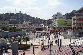
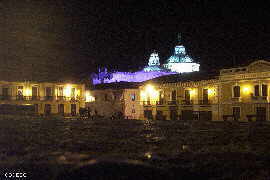
Quito - Guayaquil - Cuenca - Loja - San Cristobal - Ambato - Esmeraldas - Portoviejo - Guaranda - Azogues - Riobamba - Latacunga - Machala - Ibarra - Macas - Santa Elena - Tena - Coca - Puyo - Lago Agrio - Zamora - Vilcabamba - Mitad del Mundo - Misahualli - Atacames - Baños - Otavalo - General Information Ecuador
National Parks + Protected Areas - Yasuni - Cuyabeno - Machalilla - Cotopaxi - Chimborazo - Poducarpus - Llanganates - Ilinizas - Sangay- Railway Train - Maps - Galapagos Islands - Photos