Tourism in Babahoyo
Tourism in Babahoyo
GR
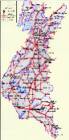
Babahoyo
Babahoyo
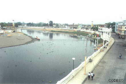
- Babahoyo is the capital of Los Ríos province and has 85,000 inhabitants.
It is located in the center of the coastal region of Ecuador, on an extensive plain, at the junction of the Catarama and San Pablo rivers, which form the Babahoyo river as it crosses the city, at an altitude of 8 meters above sea level and with a tropical rainy climate of 27°C on average.
In colonial times, it was known as "Bodegas de Babahoyo" because Customs and the Royal Warehouses were located there, for the control of trade between Guayaquil and the cities of the Ecuadorian Sierra. At the 2010 census it had a population of 90,191, making it the 17th most populous city in the country. The city is the nucleus of the Babahoyo metropolitan area, which is also made up of nearby cities and rural parishes.
The conglomerate is home to more than 250,000 inhabitants. Its origins date back to the 16th century, but it was in the mid-19th century, due to its definitive settlement, when it presented an accelerated population growth due to the large agricultural production in the area. It is one of the most important administrative, economic, financial and commercial centers of Ecuador. The main activities of the city are agriculture (mainly rice, banana and cocoa), trade, livestock and transportation.
Other destinies, cities y sites
Quito - Guayaquil - Cuenca - Loja - Galapagos - San Cristobal - Ambato - Esmeraldas - Portoviejo - Guaranda
Vilcabamba - Mitad del Mundo - Ilinizas- Misahualli - Atacames - Baños - Otavalo - Chimborazo- Sangay


OTHER INTERESTING SITES
Casa de Olmedo
- The House of Olmedo where José Joaquín de Olmedo lived, is one of the most important attractions of Babahoyo, here the treaty of Virginia was signed between the Nationalist forces and General Juan José Flores.
Puebloviejo
- Pueblo Viejo is located in the north of Babahoyo.
Quevedo
- Quevedo is located in the north of Babahoyo, in the middle of Santo Domingo. Quevedo is the second most important city in Los Ríos.
Ventanas
- Ventanas is in the north of Babahoyo.
- Vinces is in the northwest of Babahoyo. "Paris Chiquito" as Vinces is also called is a town famous for its buildings and its agricultural production.
Puerto Bajaña
- It is a freshwater spa of the Baba river near the city of Buena Fe
Playa de La Reveza
- La Reveza is an extensive freshwater beach, an important tourist site, and lies between Vinces and Mocache.

Fuentes: wikipedia, lugaresturisticos.org, etc.